Completed Projects
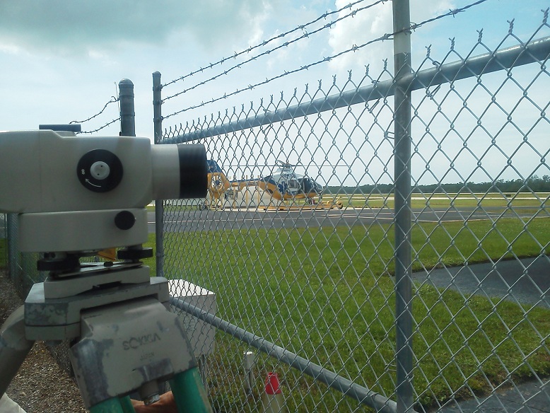
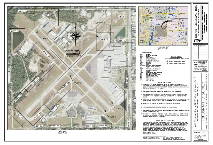
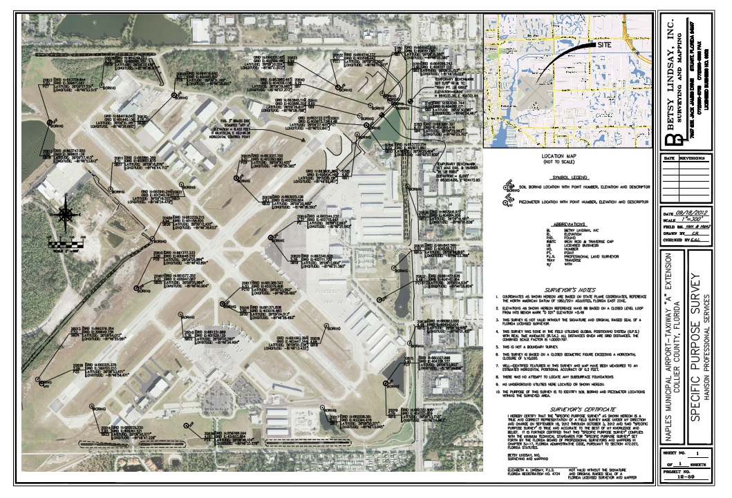
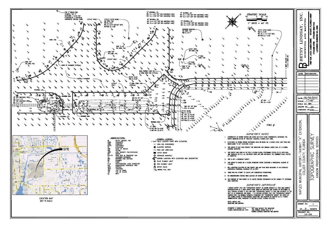
Naples Municipal Airport
Topographic Survey
The project included components to support the extension of the Runway and Taxiway B, together with components to support a drainage review of the entire site.
The party chief for this project was authorized and approved for communication with the tower.
Existing horizontal control was verified with two four hour static GPS sessions. A closed level loop was run to verify existing vertical control and to establish temporary benchmarks through out the airport site to support survey activities. A detailed survey was done of Runway 23 and Taxiway A . All onsite and adjoining offsite drainage structures were located and detailed information of each structure was collected. Horizontal and vertical values were collected for photo ID points as directed by the photogrametrist. The limits of wetlands as marked by the biologist and approved by SFWMD were located and mapped
-------------------------------------------------------------------------
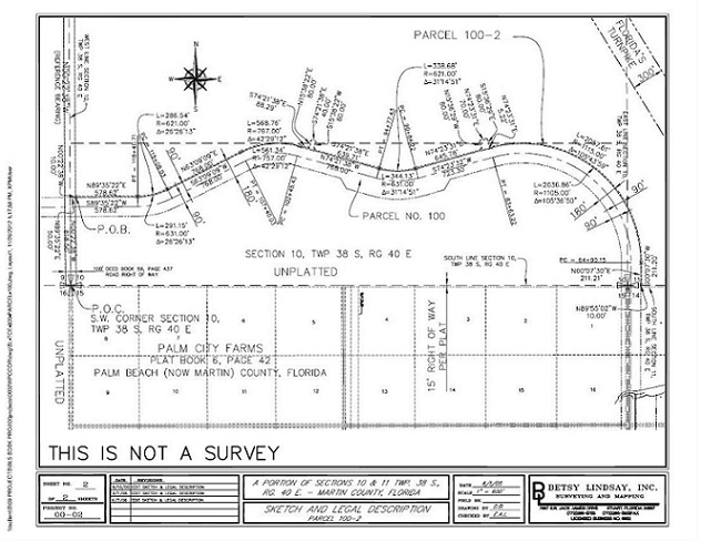
Western Palm City Corridor Phase I and II
Topographic and Right of Way Survey
The Project was managed by Elizabeth A. Lindsay. The main Crew chiefs on the project were Mike Aldrich and Tony Zubko. Darlene Buitrago assisted in the drafting of the project. This project was 7 miles long and consisted of the following;
- Preliminary Survey Services
Establish a horizontal calibration utilizing GPS with RTK and locate the limits of wetlands. - Design Survey
Establish and set the baseline of survey. Horizontal and vertical control was set near the alignment and outside the limits of construction. All work was performed utilizing the Florida State Plane Coordinate System, North American Datum of 1983/90 adjustments. A title search of the effected parcels was supplied by the client. The existing conflicting wetlands were located with a seasonal high water elevation included and a Specific Purpose Survey illustrating the location of the wetlands was supplied. Cross sections of the 300 feet - wide corridor were taken at 100 feet intervals. Cross sections of the C-23 canal were taken as directed by the client. Right of Way survey work necessary for the preparation of a Right of Way Control Survey included all necessary sections ties and property corner ties, in order to fully define the existing and proposed right of way lines was done. A Right of Way Control Survey Map was prepared illustrating the proposed alignment of the route in relation to the land it crosses. A Right of Way Map was be prepared illustrating all of the data shown on the Right of Way Control Survey together with all acquisition parcels. A sketch and legal description was prepared for each acquisition parcel. - Phase II
-Cross section the flow through marsh at 200 feet intervals (24 Cross-sections)
-Acquire additional Topography as directed by the client to support the design of the new roadway.
-------------------------------------------------------------------------
Berry Groves
Basin Reservoir Boundary, Topographic and Bathymetric Surveys
The project is located in Hendry County off SR 80. Surveying Services including setting aerial targets. Provide X, Y and Z values for targets and photo I.D. points. Perform profile checks. Establish onsite control, including GPS static sessions for horizontal control and a 14 mile closed level bench run meeting or exceeding first order class II. Soil boring locations. A Boundary Survey of the 10,491.43 acre project site was performed. This boundary survey included some complex ownership and access issues. This project also included a hydrographic component in the form of cross sections of many canals and ditches located on and off of the site.
-------------------------------------------------------------------------
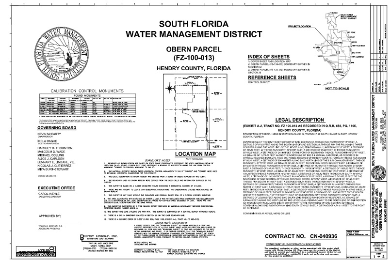
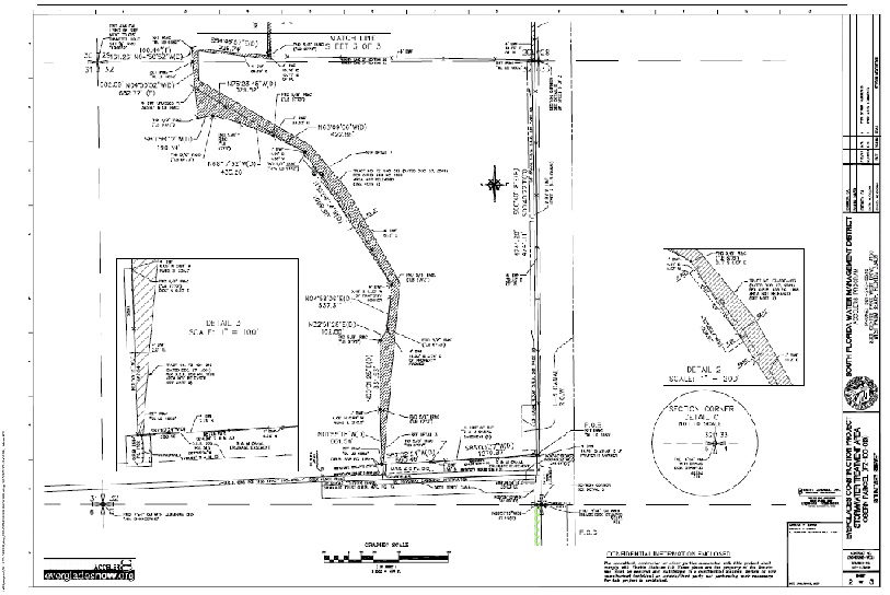
Obern Property
Large Boundary Survey
The Project was managed by Elizabeth A. Lindsay. The main Crew chiefs on the project were Mike Aldrich and Tony Zubko. Darlene Buitrago assisted in the drafting of the project. This project was 7 miles long and consisted of the following;
- Preliminary Survey Services
Establish a horizontal calibration utilizing GPS with RTK and locate the limits of wetlands. - Design Survey
Establish and set the baseline of survey. Horizontal and vertical control was set near the alignment and outside the limits of construction. All work was performed utilizing the Florida State Plane Coordinate System, North American Datum of 1983/90 adjustments. A title search of the effected parcels was supplied by the client. The existing conflicting wetlands were located with a seasonal high water elevation included and a Specific Purpose Survey illustrating the location of the wetlands was supplied. Cross sections of the 300 feet- wide corridor were taken at 100 feet intervals. Cross sections of the C-23 canal were taken as directed by the client. Right of Way survey work necessary for the preparation of a Right of Way Control Survey included all necessary sections ties and property corner ties, in order to fully define the existing and proposed right of way lines was done. A Right of Way Control Survey Map was prepared illustrating the proposed alignment of the route in relation to the land it crosses. A Right of Way Map was be prepared illustrating all of the data shown on the Right of Way Control Survey together with all acquisition parcels. A sketch and legal description was prepared for each acquisition parcel. - Phase II
-Cross section the flow through marsh at 200 feet intervals (24 Cross-sections)
-Acquire additional Topography as directed by the client to support the design of the new roadway.
-------------------------------------------------------------------------
Boynton Farms
Basin Reservoir Boundary, Topographic and Bathymetric Surveys
The project is located in Hendry County off of SR 80. Surveying Services including setting aerial targets. Provide X, Y and Z values for targets and photo I.D. points. Perform profile checks. Establish onsite control, including GPS static sessions for horizontal control and a 14 mile closed level bench run meeting or exceeding first order class II. Soil boring locations. A Boundary Survey of the 10,491.43 acre project site was performed. This boundary survey included some complex ownership and access issues. This project also included a hydrographic component in the form of cross sections of many canals and ditches located on and off of the site.
-------------------------------------------------------------------------
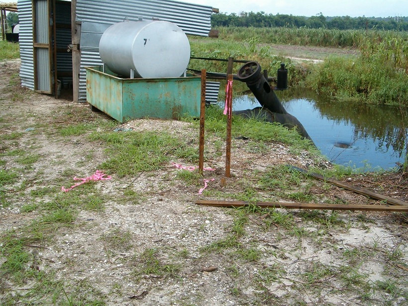
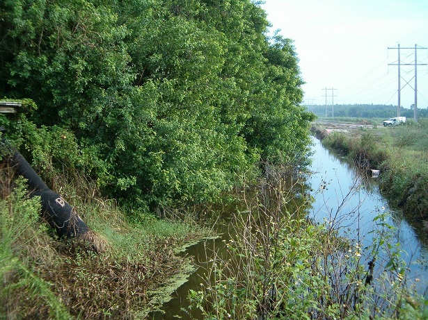
Compartment "C" L-3 Canal
Topographic and Right of Way Survey
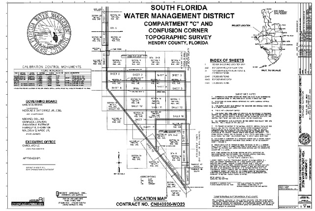
This project is located in Hendry County and is 44,825 Linear feet of the berm located along the Westerly right of way line of the L3 Canal, beginning at confusion corner and running north the end of the berm. The project manager and Surveyor for this job was Elizabeth A. Lindsay. Several Betsy Lindsay Inc. field crews were required to get the job done within the time restraints. Donna Hovanyetz and Corine Rodney assisted in the CAD production of this project. The project began with the establishment of Horizontal and Vertical GPS Calibrations to enclose the site. Acquire Topographic information to map out the entire western L-3 Levee from STA 0+00 to 448+25.0. Process the data into AutoCAD and illustrate and plan and cross sectional view of the survey data. This project included a complex right of way survey of the L-3 canal right of way. The right of way incorrectly illustrated on the SFWMD Right of Way map for this section of the canal. A thorough title search was supplied by SFWMD and additional title work was done by an outside firm. The limits of right of way were mapped and monumented.